1896 Louisiana State Map Framed Vintage Louisiana Map Wall Art Poster


VINTAGE MAP FRAMED: You'll love this high-quality framed historic reproduction of 1896 Louisiana State Map. Our ready-to-hang maps are printed and framed in the USA by professional art framers using the highest quality materials. Each order is inspected for quality.
This beautiful artwork is a perfect addition to your themed decor. Vintage maps look great in the home, study or office. They also make an unforgettable gift.
A LOOK BACK AT HISTORY: This is an impressive, historic reproduction of 1896 Louisiana Wall Map. A true piece of history. Historic prints beautifully link the past with the present.
You may find yourself staring at your historic wall art for hours in amazement. See our product description section for more fascinating information about this historic map and its significance.PREMIUM QUALITY: To display this amazing piece of history, we use museum-quality heavyweight (230gsm), fine art print matte paper. Our paper is acid-free which allows the print to retain its color quality for generations.
Our paper displays vintage map art with accurate color reproduction. This high quality print will be a wonderful addition to your vintage-themed wall. READY TO HANG: This high-quality frame displays art beautifully in almost any environment.
The frame is made out of poplar wood (for black and white) and pine wood (for walnut and natural) with a matte finish. The frame profile is 1.5 inches high and 0.75 (for size 18x24) and 1.125 (for size 24x36) inches wide. To protect artwork, we use high-quality, lightweight, shatter-resistant frame-grade acrylic.Frames arrive ready-to-hang, preinstalled with hanging hardware. HISTORIC PRINTS: We love history and art. Sometimes old maps have tears, folds, stamps, separations and other blemishes. We digitally restore and enhance maps while keeping its historical character. Our framed prints are made-to-order in the USA by professional art framers.
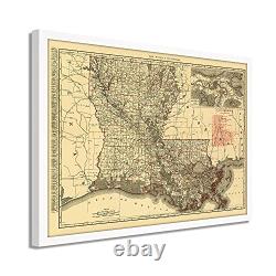
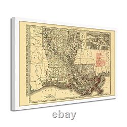
Customers all over the world love our historic prints and we know you will too. Produced by the prolific mapmaker Rand Mcnally, this railroad and transportation map of Louisiana in 1895 depicts the state in a time of great transition as reconstruction and the turn of the century approached. The Mississippi River had long been a crucial trade route for getting goods into the midwest.
The main entry at New Orleans had kept the iconic American city thriving, and the 1890s were no different. People from across the globe came through the city, and its French roots mixed with local Creole culture had developed into a distinct melting pot found nowhere else. During the Civil War, the capture of the Mississippi by Union forces marked a turning point in the war, and Union victory became apparent due to the significant importance of the river to Confederate forces. The late 20th century saw significant advances in shipbuilding, and the proliferation of locks, levees, and dams along the river started.Much of this engineering occurred to keep the river from shifting into the Atchafalaya River, thus bypassing New Orleans. The acquisition of Louisiana, as negotiated in 1803, included a vast amount of North American territory. France was engaged in multiple conflicts and needed capital to finance these clashes, allowing the new nation to acquire 828,000 sq mi of land for fifteen million dollars. This map is truly an authentic piece of cartographical history.
Our ready-to-hang wall art are printed and framed in the USA using the highest quality materials with professional craftsmanship. Historic prints look great in the home, study or office.

